صور المظاهر بواسطة MichaelJay. يتم التشغيل بواسطة Blogger.
أقسام المدونة :

الثلاثاء، 11 أغسطس 2015

The Sea Floor

The Sea Floor
Introduction

The Earth is covered by 71% ocean.

Most of what we know about the ocean floor was discovered after 1950, when advances in technology permitted its exploration.

We study the ocean floor using:
1)            Sonar
2)           Core drilling
3)           Submersibles
4)           Gravity and magnetic surveys

The ocean floor consists of sediment lying on top of basaltic crust

Therefore oceanic crust (basaltic) is composition-ally and structurally simpler than continental crust (chiefly granitic).
 Structure of the Ocean Floor 


Continental shelf
 – An underwater platform of continental crust at the edge of a continent.  It is inclined very gently seaward at an angle of less than 1°.

On the Atlantic coast of the US, the shelf is 500 km wide.  On the Pacific coast, it is only a few kilometers wide. 

The shelf is covered with young, loose, sediment derived from the land via rivers.

Continental slope – A relatively steep (~4-5°) slope extending from a depth of 100-200 meters at the edge of the continental shelf down to the deep ocean floor.

This is where the continental crust transitions into oceanic crust.

Abyssal plain – The very flat region of the deep-ocean floor, consisting of oceanic (basaltic) crust and overlying sediments.

The plain starts at the base of the continental slope.  The water depth is about 5 km.

This is the flattest feature on the Earth (overlying sediment “fills in” the rugged volcanic oceanic crust). 

Submarine Canyons- V-shaped erosional canyons incised in the continental shelf and slope, and end at the abyssal plain.

Sediment transported within these canyons is deposited in fan-shaped features called abyssal fans (analogous to alluvial fans on land).

These underwater canyons may have initially been carved by rivers during the most recent period of glaciation when sea level was lower.

Currents related to tides move up and down the canyons aiding in the transport of sediment and the erosion of the canyon.

Also, turbidity currents (underwater landslides triggered by earthquakes or strong storms) contribute to the formation of these canyons.
Types of Margins

Passive Continental Margins (East Coast of US)
 
Passive continental margin- A margin that connects continental crust to oceanic crust without any tectonic boundaries.

This is a geologically "quite" boundary without volcanoes, earthquakes, or young mountain belts.  The main activity is sediment deposition.

Passive margins include a large continental shelf, a continental slope, an abyssal plain, and a “continental rise”.

Continental rise- A wedge of sediment that lies at the base of the continental slope on passive margins.  It connects the continental slope to the abyssal plain, and has a gentler slope than the continental slope (~0.5°).

Active Continental Margins (West Coast of US)
 
Active continental margins are characterized by tectonic boundaries, volcanoes, earthquakes, and young mountain belts.

They include a continental shelf and continental slope.

The continental rise is typically absent.

Instead, oceanic trenches are present.

Oceanic trenches are the deepest (8-10 km) parts of the ocean.  They parallel the edge of a continent and are related to a subduction zone.

Trenches are characterized by earthquakes associated with the subducting slab of oceanic crust (the Benioff zone).  Volcanoes are produced above the subduction zone on the continent.

The continental slope occurs on the landward side of the trench.  The continental slope angle changes from 4-5° on the upper part to 10-15° or more near the bottom of the trench.

The Mid-Oceanic Ridge


Mid-ocean ridges are giant undersea mountain ranges.  There are 49,700 miles of mid-ocean ridges on earth.  They are 930-1550 miles wide and 1.2-1.8 miles high.

The crests of the mid-ocean ridges are rift valleys: normal fault-bounded, down-dropped areas where the crust is undergoing extension.  They are about the size of the Grand Canyon.

Mid-ocean ridges are characterized by:
1. Basalt eruption (pillow basalt's)
2. Shallow earthquakes
2. High heat flow
4. Black smokers (sulfide minerals) and associated exotic organisms (that survive toxic chemicals, high temperatures, high hydro-static pressure, and total darkness).  These organisms may give some evidence for how life first evolved on earth.
Sediments of the Sea Floor
Sea floor sediment varies in thickness but can be up to thousands of meters thick in spots.

Terrigenous sediment – sediment derived from land that finds its way to the sea floor (via turbidity currents).

Pelagic sediment – sediment that settles slowly from ocean water.  It is made of:
a)            Fine grained clay- washed to deep sea.
b)           Volcanic ash- airborne fallout
c)            Skeletons of microscopic organisms (foraminifera and radiolarian).
The Age of the Seafloor
The age of oceanic crust and seafloor sediments do not exceed 200 million years in age (~ Jurassic).  In contrast, the oldest crustal rocks are 3.7 - 4.3 billion years old.

The young ages reflect recycling of dense oceanic crust at subduction zones.

الاثنين، 10 أغسطس 2015

Indian plate is pushing on Eurasia (earthquake)


Yet another incident evident of the Indian plate movement towards North into the Eurasia. Another earthquake struck Pakistan few minutes back (10 August,2015) . Magnitude calculation shows was 6.7 on the Richter scale while it shake most of the Pakistan. The focal point is to be in the Eskasem, Badakhshan, Afghanistan-Tajikistan border. It epicentre was 200 kilometres below surface while the surface waves was propagating about 15 seconds. 
This simply is the evident of the Indian plate movement while in the past couple of days, being too active. As one earthquake struck today while 7 is the count for the last past week. Its count in a month goes to 16 while 150 in year time. Crustal deformation is still active, mountains being getting higher like 7 millimetres annually. 
If the movement continues with this speed its far enough but what about some higher rate?. Probably it will go on a higher rate as to see the count of earthquake in this very active zone where Afghanistan, China, Pakistan, India, Nepal and Tajikistan lies. Faults being activated with intervals, different epicentres and will continue to do so. As there are many major faults in this area with to many minor faults, each the resulting force Indian plate due on the Eurasia. 
So as now the movement of the Indian plate is northward, will it drift the the southern parts toward North?. Surely will but the feel is not so huge as it only measures to be centimetres and not like metres. As both are large masses no one can push aside each other so it keeps mountain ranges building, old ones keep higher and higher while, the new deformation zones keep on their deformation because the force is to accommodate and later folds transform into faults and gives more earthquakes.

الأحد، 9 أغسطس 2015

Earth axis has changed


The axis of rotation of Earth is the one that determines the season of our planet. Earth axis as believed previously is the 23.5 degrees which is known from a long time but it's not any more the same as before but has shifted not gradually. There is no reason to include for the shift but evidence can provide the shift. Earth’s Axis has modified where the evidence for it is right in front of us. The season has drifted more ahead. Few years back it, the winter start was from September with intense in December but not any more. The winter now has shifted from September to November with intense in January and February and yet is dragged a lot to April and May. There will in all probability be a lot of weather over future month. Possibly more into March and April. North east is being pounded with historic levels of “Snow hurricanes”. The sun that ought to never be farther north than the tropic of Cancer in middle Mexico or farther south than the Tropic of Capricorn in middle Australia is currently considerably on the far side those points. The sun is currently regarding 2000 miles too way north within the summer shining in our northern windows and too way south within the winter shining in their southern facing windows at sunrise and sunset. 

The orbit round the sun had probably altered the direction of the angle  observations and measurements of the abnormal position of the sun due to a big shift of our axis in Dec 2004 is currently verified.

However, it's additionally considerably shifted once more within the past year for the primary time since 2004. You can measure it for yourself when you see the sun position is too far north of your home in June (northern hemisphere) when it should never be north of the Tropic of Cancer and too far south in the winter.
Many people don't seem to be tuned in to true. You can look into the sun position and verify the weather changes.

Sedimentary Rocks

Sedimentary Rocks:

Sediments are loose rock particles, produced by one of three mechanisms:

1) Weathering of preexisting rocks, followed by transportation and deposition (produce clastic sedimentary rocks such as sandstones, breccias, and conglomerates).
2) Chemical precipitation of minerals from water (produce chemical sedimentary rocks such as limestone and evaporites).
3) Accumulation of biological matter such as shells and plant fragments (such as coal).

Sediments that are buried may harden into sedimentary rock through a process know as lithification (a combination of compaction and cementation)

From Sediment to Sedimentary Rock

Prior to lithification, sediment experiences two major events:

1)  Transportation- The movement of sediment away from its source rock by water, wind, or ice

Rounding of particles occurs due to abrasion during transport.  Rounding increases as transport distance increases.

Size sorting occurs by transport agents, especially running water.  Sediment size decreases as transport distance increases.

2)  Deposition- The environment of deposition is the location where deposition occurred.  Examples of environments of deposition are:

River Channel
Lake Bottom
Delta
Beach
Deep Ocean
Desert Dunes


Classification of Sedimentary Rocks by Origin

1) Clastic (or detrital) sedimentary rocks- Form from the cementation of sediment grains that come from pre-existing rocks.  This is the most common sedimentary rock type.  Clastic sedimentary rocks are classified by grain size, and to a lesser extent by chemical composition.

Boulder - >256 mm
Cobble - 64 to 256 mm
Pebble - 2 to 64 mm
Sand - 1/16 to 2 mm
Silt - 1/256 to 1/16 mm
Clay - <1/256 mm


Breccia- A coarse-grained clastic rock composed of angular rock fragments cemented together (poor rounding).

Breccia. © Marli Miller, University of Oregon.


Conglomerate- A coarse-grained clastic rock made of rounded gravel cemented together (good rounding).

Conglomerate, © Marli Miller, University of Oregon.


Sandstone- A medium-grained clastic rock.

Sandstone, Public Domain Image, USGS (Minerals in your World Project).

Sandstones are subclassified based on the chemical composition:

Quartz sandstone - Contains >90% quartz grains.
Arkose - Contains mostly feldspar and quartz grains mixed together.
Graywacke - Contains sand grains surrounded by dark, fine-grained matrix (they are "dirty" sandstones).


Siltstone- A fine-grained clastic rock.  Siltstones have a gritty feel, and the individual grains are visible with a hand lens.

Siltstone, Public Domain Image, USGS (Minerals in your World Project).


Shale- A fine-grained clastic rock containing silt and clay-sided grains.  Shale spits into thin layers, a behavior known as fissile.  Shales feel smoother than siltstones.

Shale, Public Domain Image, USGS (Minerals in your World Project).

Mudstone/Claystone- Mudstone is made of silt and clay-sized grains.  They are blocky (non-fissile).


2) Chemical (and biochemical) sedimentary rocks- Chemical sedimentary rocks form by the precipitation of minerals from water (this process may or may not involve the actions of organisms).  In contrast to the clastic textures of the rocks discussed above, chemical sedimentary rocks have crystalline textures.


Limestone- A chemical sedimentary rock composed mainly of calcite (CaCO3).

Fossiliferous limestone, Public Domain Image, USGS (Minerals in your World Project).

Most limestones are biochemical, but many are inorganic.

They often contain easily recognizable fossils (fossiliferous).

Chemical alteration of limestone in Mg-rich water can produce dolomite, CaMg(CO3)2.


Chert- A hard, compact, fine-grained chemical sedimentary rock composed almost entirely of silica (SiO2).

 
Chert, Public Domain Image, USGS (Minerals in your World Project).

Chert can occur as layers or as lumpy nodules within other sedimentary rocks, especially within limestone.

Some cherts are primary precipitates, but others formed by replacement of pre-existing material by silica.


Evaporates- Evaporites are chemical sedimentary rocks that grow upward from seas and salt-rich lakes due to water evaporation.

Delicate evaporites
© Larry Fellows, Arizona Geological Survey.

Common evaporite deposits are gypsum, CaSO4•2(H2O), and halite (NaCl).


Organic sedimentary rocks- Fossil fuels are sedimentary rocks with a biological origin.

Coal- Coal is a sedimentary rock formed from the compaction of partially decayed plant material (requires stagnant water and rapid burial).

Oil and natural gas- “Cooking” below Earth's surface can change organic solids into oil and natural gas.  These fossil fuels rise and accumulate in porous overlying rocks.


Sedimentary Structures

Sedimentary structure- A features within a sedimentary rock that provides clues about the environment of deposition.

1) Bedding: Series of horizontal layers within an outcrop of rock.  The most common sedimentary structure.
Shale with interbedded limestone. © Marli Miller, University of Oregon.


2) Ripple marks: Small ridges formed on the surface of sediment layer by moving wind or water.  Symmetrical ripples represent water wave ripples, whereas assymetrical ripples represent water current or wind current ripples.

Sand dunes of Death Valley, © Marli Miller, University of Oregon.
Ripples on sandy beach in southern Alaska, © Marli Miller, University of Oregon.

Ripple marks on sandstone of the Triassic Chinle Formation, © Marli Miller, University of Oregon.

3) Cross-bedding- Series of thin, inclined layers within a horizontal bed of rock that represent the preservation of migrating dunes.  You are looking at the side of a bed rather than the top of the bed.

Cross-bedding structures in the Navajo Sandstone of Zion National Park, © Marli Miller, University of Oregon.

4) Graded bedding- A type of bedding where grain size gets smaller from bottom to top due to sorting of grains under water.  This type of bedding results from underwater landslides (called turbidity currents) initiated by earthquakes.

Graded bedding in matrix supported conglomerate from the Pliocene Copper Canyon formation, © Marli Miller, University of Oregon.

5) Mud Cracks/Dessication Cracks- Polygonal cracks formed in mud that dries upon exposure to air (common in dry lake beds and tidal flats).

Mud cracks in the bed of the Amargosa River in California's Death Valley National Park, © Michael Collier.

Ancient mudcracks (shrinkage cracks) preserved in red-brown mudstone near the base of the Watahomigi Formation, Public Domain Image, United States Geological Survey.

6) Fossils- Any evidence of past life preserved in rock.  Hard parts (shells, bones) are the most easily preserved parts of organisms.
Fossils can give detailed information about the environment of deposition.
Trilobite. © Oklahoma University

Animal footprints in Coconino Sandstone of Aubrey Cliffs, Arizona- Courtesy United States Geological Survey.

الجمعة، 7 أغسطس 2015

Point counting technique used in petrography

What is point counting?


Point investigation may suggests that of describing rock in an unbiased and quantitative means.

A rock which could be represented within the field as “Fine-grained Sandstone” has additional way more data to relinquish up once examined more closely. a skinny section viewed underneath the magnifier could show grains of variable sizes, overgrowths on those grains, overgrowths of various clays, every of variable designs and habits, pore areas between the grains, pores part crammed, grains part dissolved, and so on, in nearly infinite detail. most components of the detail area unit of interest to 1 or alternative of the specialist geoscientists answerable for creating an initial exploration appraisal of an opportunity, or for developing a promising prospect, or for exploiting the known field. it's the task of the petrographer to amass and document this data and purpose investigation is that the principal technique used.

Point investigation may be a applied mathematics technique. It involves watching an outsized range of points on the slide, recording precisely what's seen at every purpose and so collecting an outline from all the knowledge recorded. so as to be a statistically valid illustration, the amount of points represented is usually three hundred – five hundred.

Moving the slide that range of times, and guaranteeing constant purpose isn't represented quite once, may be a important task. concerning forty years agone, Swift Engineering developed a tool that enraptured the slide in equal increments on a line; at the tip of a line, the petrographer would re-set it to the beginning and move it up a line, very much like employee performed a “carriage come back and line feed” operation.

Added to the current, Swift, and later previous Scientific Instruments, developed a 20-channel device for recording up to twenty completely different classes of things seen. however twenty is way too few for the big range of minerals, clays, pore varieties and alternative materials of interest found in an exceedingly skinny section, even before we tend to try and record the habit and morphology, the combos, and therefore the diagenetic relationships.
Number of points to count and “1.5 times grain size”

By contrast, if we were to take the same thin-section dimensions as previously but now with a rock which has an average grain size of “Very Coarse Sand Upper”, we would find that the “step size (at least) 1.5 times grain size” adage means we run out of rock to look at when we have stepped about 130 times. We simply cannot get enough material to look at. What has gone wrong this time?

We have to look again at why we are point-counting. The reason is to collect data from a representative sample of the rock, and hence to be able to make predictions or deductions about the rock as a whole. Where did “400 points” come from? And why “1.5 times grain size”? What do they contribute to the determination of a strategy for finding a representative sample of rock?

If you are an oil company sedimentologist feeling hard-done-by because you have to describe 400 points on your slides, think of coal petrologists working to the ICCP recommendation of 900 points. But even they are getting off lightly: ASTMS recommend 2000 – 4000 for clinker. Where do these numbers come from? Felix Chayes is frequently referred to as the father of mathematical geology and in 1953 he published a discussion of how variability in the rock should determine the target point count. This should be obvious: if we have counted 300 points already and they were all quartz, the 301st point is odds-on not to add any new information, the relative percentages will almost certainly remain unchanged; if we have counted 300 points already and 100 were quartz, 100 feldspar and 100 microcline, then the 301st pint is bound to change the relative percentages, but only slightly; but if, at the other extreme, every one of those 300 points was a different mineral, then the 301st is going to effect a large percentage change, no matter what we see there. Logically, if we want a statistically representative (or, to put it another way, accurate) description of the rock, we should keep counting until the changes effected by further counting are negligible.

The “magic number” approach to setting point count targets is a hangover from a bygone age. If one has no simple way to place a grid over a slide, then step size is a simple, if crude and inefficient, means of determining a sampling strategy. The dictum “1.5 times average grain size” comes from a desire not to count a grain twice. This itself is dubious thinking (if we were sampling the electorate in Britain, would we only ask one person in London, because we don’t want to ask Londoners twice? I appreciate that this is different in kind and in principle, but should at least serve to provoke thought) but is worse if it leads us to count the wrong number of points. It is surely obvious that, if there are fewer but larger grains, we shouldn’t be counting less points. (It may be less obvious that there is an implication that we should, on the contrary, be counting more points; statistical theory is occasionally counter-intuitive and we will come back to this point).

Number of steps is most frequently determined by accountants rather than geologists. With the predominance of out-sourcing, number of points to count will usually be determined by available budget. More correctly it should be determined by our degree of tolerance for errors taken with our expectation (based on background knowledge and experience) for spatial and statistical variation in the rock.

If we start with a knowledge of what the data will be used for, and hence how much we can tolerate errors, we can devise a point-counting strategy to suit. For example, if the petrophysicists wish to know whether certain trace minerals are present, we should count until we have a reasonable confidence that, were they present, we would have seen them. Statistics is very good at measuring and determining this kind of confidence: tests exist which, if applied correctly, will give us a numerical measure of confidence. We can ask the petrophysicist: “How sure do you want us to be – 90% confident? 95% confident? 99% confident?” and, based on her/his answer, determine how many points we should count.

The additional input to this calculation of confidence is the geologists expectation of variation in the rock. We can, however, refine this as we go along, by determining the actual degree of variation in this particular thin section. This would add inordinately to the effort if tallying manually, even using one of the ready-reckoned graphs as published by, for instance, xyz; but, if using a computer to do the tallying of counts, it is trivial to ask the computer to tell us when to stop counting, based on our target for percentage confidence.

Different answers might come from the engineers, who are only going to average our data into blocks hundreds or thousands of times the size of our thin sections, or from specialist geologists, who may be using the data as input to models for determining diagenetic history, basin development, etc. In each case, we can determine a strategy from the requirements – are we trying to catch odd occurrences of extreme events (trace minerals) or quantify relative abundances of significant occurrences (e.g. clay habit)? – and, if necessary, take the worst case from each to allow the data to be of maximum use to all parties. The down side is that someone has to think: this becomes a genuine test of skill, using a large amount of background information on the specific rocks or on rocks from similar environments, instead of a simplistic application of a universal formula handed down through the generations and having little or no relevance. It is therefore a task for the geologist, not for the company accountant.

الخميس، 6 أغسطس 2015

Is There Oil Beneath My Property?


Is There Oil Beneath My Property? First Check the Geological Structure

Accumulations of crude oil and gas require a source rock, which is an organic-rich sedimentary rock that produces petroleum as the organisms decompose following burial. Petroleum migrates from the source rock until it encounters impermeable rock or the earth's surface, where it is lost in seeps. Porous and permeable reservoir rocks allow petroleum to accumulate below impermeable layers. Geologic structures provide traps to further concentrate the accumulating petroleum. Anticlines are the best traps and the first recognized by geologists searching for oil. These structures can form "oil pools" with stacked levels of water (lowest), oil and natural gas (highest) against the impermeable rock above the reservoir.


Other types of traps have been recognized including faults, unconformities, and facies changes. Modern petroleum exploration is sophisticated, but there is no way short of drilling to determine the presence of oil. "Wildcat" wells only have a 1 in 10 chance of discovery, which explains why future oil supplies will be more difficult and costly to find.........
.........       

Oil Trap

A set of conditions that hold petroleum in a reservoir rock and prevents its escape by migration.

Major types of Petroleum Traps.  In all cases, impermeable rock encloses or caps the petroleum.


Types of fossils


What it a fossil? 


The word fossil is derived from the Latin fossilis meaning an object that has been dug up from the ground. Fossils are the evidence for the existence of once-living animals and plants and may be either the preserved remains of an organism or evidence of its activity. 

Types of fossils

Trace fossils


Trace fossils are the preserved impressions of biological activity. They provide indirect evidence for the existence of past life. They are the only direct indicators of fossil behaviour. As trace fossils are usually preserved in situ they are very good indicators of the past sedimentary environment. Trace fossils made by trilobites have provided an insight into trilobite life habits, in particular walking, feeding, burrowing, and mating behaviour.

Chemical fossils 


When some organisms decompose they leave a characteristic chemical signature. Such chemical traces provide indirect evidence for the existence of past life. For example, when plants decompose their chlorophyll breaks down into distinctive, stable organic molecules. Such molecules are known from rocks more than 2 billion years old and indicate the presence of very early plants. 

Coprolites


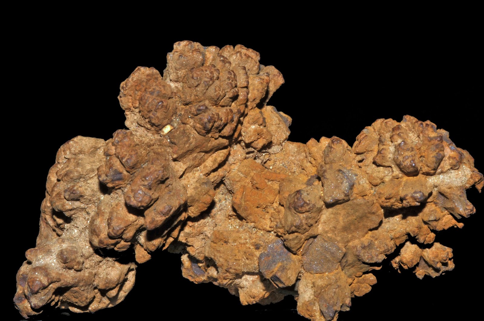
Coprolites are fossilized animal feces. They may be considered as a form of trace fossil recording the activity of an organism. In some coprolites recognizable parts of plants and animals are preserved, providing information about feeding habits and the presence of coexisting organisms. 

Body fossils 


Body fossils are the remains of living organisms and are direct evidence of past life. Usually only hard tissues are preserved, for example shells, bones, or carapaces. In particular environmental conditions the soft tissues may fossilize but this is generally a rare occurrence. Most body fossils are the remains of animals that have died, but death is not a prerequisite, since some body fossils represent parts of an animal that are shed during its lifetime. For example, trilobites shed their exoskeleton as they grow and these molts may be preserved in the fossil record.

Interested for our works and services?
Get more of our update !